


Tracing Islais
Tracing Islais
A walking tour of the historic Islais Creek Watershed


If you’re standing at the top of Glen Canyon Park and you stomp around, you might just get your feet wet. The story of the Islais Creek Watershed starts here: Glen Canyon Park in San Francisco. Glen Canyon acts as a great, big funnel for Upper Islais Creek, with its steep walls sloughing stormwater down into the valley below. While it may be hard to see through the thick willows and horsetails, the creek is there and it's essential in supporting a diverse streamside habitat. Yet all of this ends abruptly near the Glen Canyon Recreation Center where the creek is forced underground into a culvert, invisible on the rest of its winding journey to the Bay.

What does the rest of San Francisco’s largest creek system look like above the surface today? If you walked it, it would be an almost 5-mile, 2-hour trek. Taking inspiration from artist Bonnie Sherk’s A Living Library (A.L.L) Nature Walk, SF Parks Forward took to tracing Islais through time and space. Along the way, we identified the green spaces that lie along the historic creek path and analyzed how the built environment has altered Islais. Join us!

If the starting point was the top of Upper Islais Trail, Stop 1 is its lower elevation cousin: the Glen Park Greenway. East of the final point where the water sees daylight, the creek snakes under the Greenway, a tactically positioned ecological corridor along the old creek bed. Doomed to be the site of the Crosstown Freeway in the 1960s, neighborhood activists known as the Gum Tree Girls saved this area so that the Greenway could offer a glimpse of what a continuous creek corridor might look like. You’re not just going to find arboreal salamanders and great horned owls here; the Greenway is also home to its own species of joggers, bikers, dog walkers, and commuters hopping off the Glen Park BART after a hard day's work. BART and the adjacent freeway actually mark the end of a traceable creek footprint. Why is that?

The not-so-simple answer: multi-generational cycles of industrial/maritime expansion in the city's southeast corner took advantage of what land and existing infrastructure were available. Islais Creek was a part of this infrastructure, but not in the way nature intended. In the mid-1800s, farms dotting Islais’ banks were eager for irrigation. The Gold Rush and Port booms brought more settlers to the area, densifying an increasingly claustrophobic Islais floodplain. These settlements would evolve into the meat-packing and processing operations of Butchertown in the early 1900s. That meant lots of waste was dumped right into Islais Creek. The watershed transformed from a jewel of the city to a toxic sewer in just a few decades. Islais’ industrial saga came to a head with the devastating 1906 Earthquake. Much of the debris from the earthquake was used to fill the eastern waterfront, including the Islais Channel’s tidal marshlands, spurring the trend of “building over” rather than “building with” Islais. This trend would continue with the construction of San Francisco’s Highway 101 (1926) and I-280 (1956) directly over the creek. Unfortunately, its low elevation and relatively flat topography made the creek a good candidate for freeway construction.

With all this in mind, we travel along the 1.8 mile stretch along the freeway and Alemany between Glen Park and the Portola where the only two accessible green spaces are St Mary’s Playground and the Alemany Farm at Mile 1.9 (Stop 2). Imagine if these two treasured green spaces had the creek to not only support their operations but also to improve our connection to nature in the city. Alas, equitable park access is not synonymous with Islais these days. If one was traveling from Glen Park or the Excelsior, getting to St Mary’s and Alemany requires you to traverse over or under the eight-lane I-280. Going over? You’re on a narrow, caged footbridge blasted with noise pollution from the freeway below. Going under? You’ve just become an amateur tightrope walker on a narrow sidewalk beside a crowded thoroughfare. At best, this stretch of the walk is less than ideal for pedestrians and bikers, and a detriment for folks with mobility impairments. At worst, the Alemany section is a serious hazard for all non-car users.

For now, this is goodbye to green and hello to gray. Continuing east, crossing under the 280 and the gargantuan interchange at Alemany and Bayshore, we find ourselves dabsmack in the industrial basin (Mile 2.9, Stop 3). As decided by the California State Legislature in the 1920s, this part of the creek became the “Islais Creek Reclamation District,” specifically zoned for industrial development in connection with the Port. Historically, industry has been in opposition to parks, green space, and habitat. History is still alive and well. The final 1.1 mile, 36 min stretch from Alemany and Bayshore to the Islais Creek waterfront features no parks or open spaces on the most direct route, with the exception of the recently built Southeast Community Center at Evans and Third. Even so, we just went 2.3 miles (almost an hour walking) without running into a single park or green space.


We end our walk at the Islais Creek Channel which hosts a number of small parks and open spaces. Islais Creek Promenade, Islais Creek MUNI Park, and Tulare Park comprise the north side of the channel. The south side is home to Islais Creek Landing, a favorite for kayakers, and Bayview Gateway, a multi-use plaza between Illinois and Third St frequented by skaters. While this channel has a number of parks along its path, the open spaces in this area are poorly integrated with Islais Creek and each other. Stretching a mile from the outflow under the CalTrain tracks to the Bay, this is one long opportunity to improve connections to the creek, rather than build against it with cement barriers and other infrastructure that discourage shoreline access.

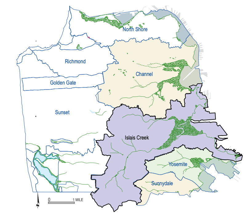
So far, we’ve focused mostly on human interaction with the creek. The Ohlone people cherished Islais as both a freshwater source and a key habitat for hunting and foraging. Early settlers irrigated the creek for agriculture and industrialists found it to be an optimal site for dumping. We drive over it today. However, that doesn’t paint the full picture. Beyond our own uses for the creek, Islais Creek accomplishes an incredible natural feat: managing stormwater for nearly 7000 acres of drainage. Remember the puddles at the top of Glen Park from earlier? They’re just a tiny splash in a massive hydraulic system, one that existed long before any human settlement.
It’s important to remember the watershed’s pre-built history in light of our current urban reality. With almost 90% of the creek underground in a combined sewer system, the Islais Creek of today is not ready for the storms of tomorrow. According to SFPUC, the current system is only built to withstand a 5-year storm before experiencing surcharge and flooding in the surrounding regions. And when the surrounding regions are primarily low-lying and built with impervious surfaces, flood effects are felt hard by residents, businesses, and transportation networks alike. Avoiding such calamity is going to take a top-to-bottom approach. The more we aim to restore the Islais watershed to its former glory, increasing natural stormwater capacity in the process, the more proactive we are in protecting adjacent communities well into the future. Parks aren’t just an added bonus in this vision, they’re central to the co-benefits of a restored watershed, a resilient city, and a sprawling creekside corridor for all to enjoy.
In 2024, daylighting Islais Creek would unsettle just about everything in this part of the city. Small businesses, bus lines, BART, highways, and several San Francisco neighborhoods all abut Islais Creek. But it's a disruption we should embrace in the long term. While it may be discouraging to see just how different Islais is now compared to back then, the built environment of today, in all its interconnectedness, is a fantastic template for a future that’s more harmonious with nature. That future begins with an awareness of the historic Islais Creek Watershed and its potential benefits to San Franciscans of all flora and fauna varieties. As seen with the Tracing Islais Concept Path, we can foster this awareness by reconnecting with our natural surroundings, including the watersheds and hidden creeks running beneath our feet. Somewhere downstream, this understanding will turn towards restoration in the form of a daylit and continuous Islais Creek. From a walk, to a quick build project, to a permanent transformation, sometimes a small and symbolic gesture is what it takes to get the ball rolling. All the way from Glen Canyon to the Bay.
